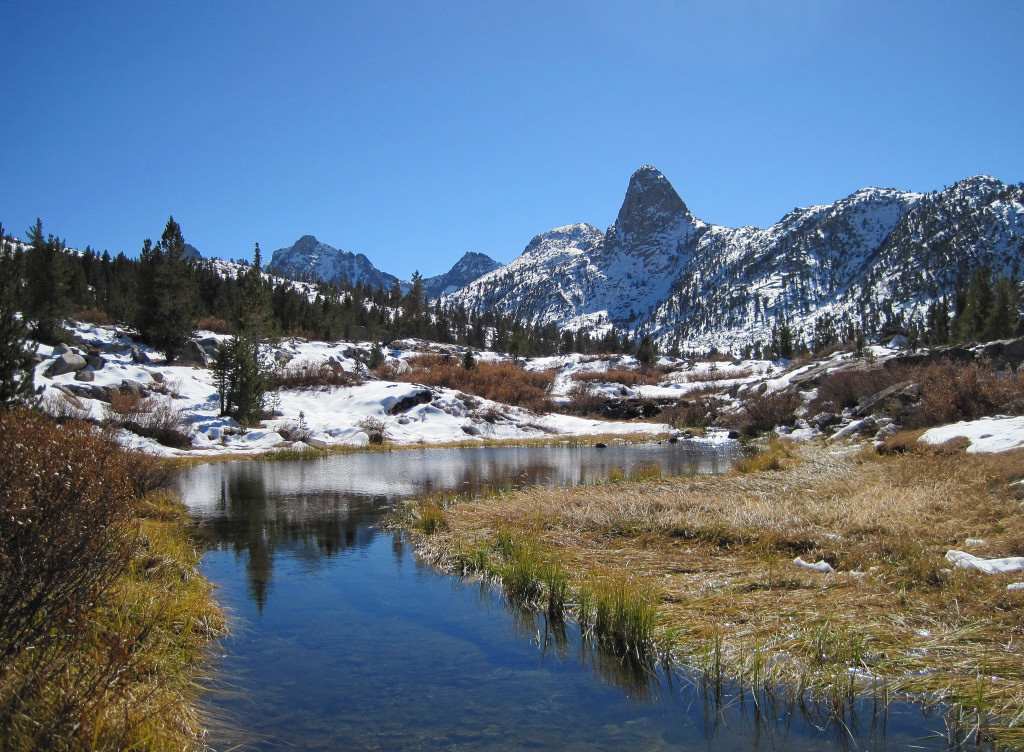
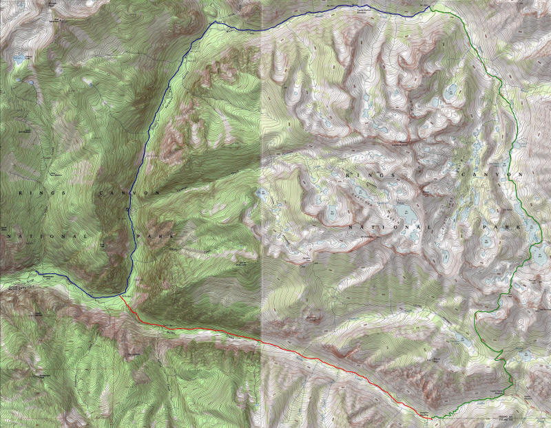
According to the national park service, the Rae Lakes Loop is one of the most popular hikes in Sequoia and Kings Canyon, if not the entire Sierra. I completed the famous loop in 12 hours, 31 minutes, starting at 5:30 am and finishing just after 6 pm. The loop is 46 miles long and climbs from 5,035 ft at the trailhead to 11,978 ft at Glen Pass. The portion between Vidette Meadows (Mile 14) and Woods Creek Crossing (Mile 29) is along the John Muir Trail. The highlight of the loop is the Rae Lakes area, a chain of large alpine lakes over 10,500 feet with views of rugged Sierra peaks. The trailhead is at Road’s End in magnificent Kings Canyon and travels along Bubbs Creek and Woods Creek, including Vidette Meadows, Castle Domes, and Paradise Valley. Most backpackers do the loop clockwise, which makes sense as you gradually gain elevation through the Rae Lakes basin. However, for running it makes more sense to go counterclockwise reaching the highpoint at Glen Pass in 18.5 miles, followed by 27.5 miles of downhill, in theory (there are lots of blips).
A strong storm on October 13th dropped several feet of snow above 9,000 feet, and a substantial amount of snow remains which made for slow going between Charlotte Lake junction and Dollar Lake (~8 miles). The snow was particularly deep on the north side of Glen Pass with an icy crust layer on top of powdery snow. The result was a lot of postholing and I often could not find where the trail was buried until near the Rae Lakes, but the views of the Sierra with a fresh coat of snow more than compensated. The trails along the loop are generally rocky and rugged precluding a consistent fast pace. I found the section before and after Mist Falls (miles 41 to 43) to be particularly rocky and rough on tired legs at the end of the day.
Complete trip report with many photos and splits here or on Cascade Climbers. Map here.
Splits after the jump!
